


Before I went, I lazily thought of North Brazil as one giant green blob. “The Amazon,” I told friends, imagining a uniform wall of jungle from the Andes to the Atlantic. After several weeks zigzagging through Amazonas, Pará, Tocantins and Roraima, I realized how wrong that picture was. The North is seven very different states, stitched together by rivers and red dirt highways, where a 200-kilometer journey can take twelve hours and a three-real cup of cupuaçu juice tastes more vivid than any postcard.
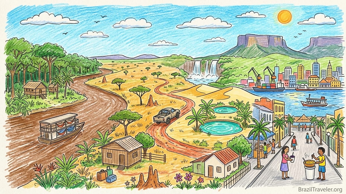
North Brazil Is Not One Homogeneous Rainforest
On maps, Brazil’s North Region looks like a single green mass. In reality, it spans seven states: Amazonas, Pará, Acre, Rondônia, Roraima, Amapá and Tocantins, covering most of the Amazon Basin plus big pockets of savanna and cerrado. Official regional definitions by Brazilian institutions list exactly these seven states as the North, and being on the ground there, I finally felt how different they are in climate, culture and logistics.
In Amazonas, where I started, the air around Manaus felt heavy even before sunrise, a wet heat that clung to my T-shirt five minutes after leaving the air conditioning. On the boat up the Solimões, the river looked like chocolate milk and the forest a continuous wall. A week later in Tocantins, driving into Jalapão, the horizon suddenly opened into ocher grasslands, termite mounds and dusty tracks. The humidity dropped, the nights cooled, and the forest became patches of gallery trees instead of a blanket of canopy. North Brazil is not one ecosystem and certainly not one style of trip.
Pará added yet another layer. Belém, sitting on Guajará Bay at the mouth of the Amazon system, mixed river ferries and palm-lined avenues with a noisy, urban food culture built on açaí, cupuaçu and manioc. When I later flew up to Boa Vista in Roraima, it felt more like a frontier town in the savanna than the deep rainforest. The conversations shifted to overland expeditions, border crossings and long-distance buses rather than only river boats and jungle lodges.
This variety matters when you plan. The wet and dry seasons do not arrive at the same time everywhere, health risks change from river to savanna, and buses, boats and small planes fit together differently in each state. My own route, stitched together without that nuance, meant I rushed some places and lingered in others. If I went back, I would treat each state as a distinct trip instead of “doing the Amazon” in one sweep.
Manaus and Central Amazonas: Heat, River Life and Slow Boats
I flew into Manaus from São Paulo on a three-and-a-half-hour Gol flight, landing at Eduardo Gomes International Airport in the late afternoon. The moment the cabin door opened it felt like a wall of steam hit my face. Walking from the plane to the terminal, my glasses fogged. Later I checked the weather report out of curiosity and saw relative humidity hovering around eighty percent, which matched how my clothes stayed damp long after I showered.
From Manaus I wanted to see the forest beyond day tours, so I booked a combination of a public slow boat and a stay at a small lodge near the Rio Negro. Out of the Port of Manaus, I watched locals string hammocks side by side on the deck of a double-decker boat, paying the crew a modest fee for a three-night trip up to Tefé. When I asked about time, a ticket seller shrugged and said, “Quatro dias, mais ou menos” – four days, more or less. Schedules on paper exist, but current river levels and how many intermediate stops really decide arrival time.
I only rode the first, shorter section to an intermediate town, and even that surprised me. A route that I naively thought would take six hours lasted almost ten, with long pauses while cranes swung sacks of flour and crates of soda on and off the boat. On deck, a woman ladled out bowls of fish stew for roughly the equivalent of a few U.S. dollars. I ordered fried tambaqui ribs with farofa and rice, wrapped in foil on a plastic plate. Between bites, I watched the river widen until sometimes I could barely make out the opposite shore. It felt more like crossing a shallow sea than a river.
Nights in the forest lodge near Manaus were a sensory overload. After sunset the temperature dropped slightly, but the humidity rose again and every sound amplified. The loudest noise came from the frogs, a layered chorus of beeps and croaks, underlined by the occasional splash of a fish or the whir of insects hitting the mosquito net. Inside the simple wooden bungalow, a fan pushed hot air around; the thin mattress clung to my skin. The lodge arranged a night canoe trip, and the guide killed the engine mid-channel. In the dark, the forest smelled of damp leaves and mud. Somewhere above us, howler monkeys roared like distant engines.
The rainy and dry seasons shaped everything. In central Amazonas, locals described two seasons: a “winter” from roughly December to May when afternoon storms swell the rivers, and a relatively drier period from June to November when some smaller channels become sandbanks. On one flooded-forest tour in March, the guide steered the canoe between tree trunks where, in September, you would walk on dry ground. That meant I could glide silently through submerged igapó forest, but it also meant more insects, sticky clothes and the daily risk of a soaked backpack if I mistimed walks between sudden downpours.
Belém and Pará: River Ferries, Street Food and Endless Rainshowers
From Manaus, I flew to Belém with Azul, following a route that hopped via Santarém. I deliberately skipped the multi-day hammock boat down the Amazon after hearing that in low-water years it could be more discomfort than adventure. By the time we descended over Belém’s Guamá River, the landscape had changed again: a tangle of channels, islands and low-lying neighborhoods broken up by church towers and port cranes. The arrival felt coastal, more Atlantic than deep jungle.
Belém hit me first through smell and taste. At the Ver-o-Peso market, the air carried a mix of river mud, grilled fish and crushed herbs. Under a corrugated metal roof, vendors sold açaí by the bucket. This was not the frozen, sweetened smoothie bowl version; it was thick, unsweetened pulp that locals ate with fried fish and tapioca flour. I paid for a small plastic cup of açaí alongside grilled tacacá shrimp soup seasoned with jambu, an herb that made my lips tingle and numb. Around me, office workers in pressed shirts slurped the same soup on their lunch break.
An afternoon thunderstorm rolled in like a train. Locals told me that from December through April, Belém often gets heavy rain nearly every day in the early afternoon. That matched my experience. One day I tried to walk from my guesthouse near Nazaré to the old city, a straightforward 25-minute route on the map. Dark clouds built over the river, the wind picked up, and within minutes the street flooded ankle-deep. Street vendors pulled plastic tarps over their stalls. My simple walk turned into a soaked, hour-long zigzag under awnings and arcade fronts, with me passing a group of kids laughing and body-surfing in the brown water swirling around the pavement.
Belém also taught me practical lessons about money and safety. In the historic center, some small bars, açaí stalls and market counters were cash-only, especially around Ver-o-Peso. Nearby shopping centers, on the other hand, accepted cards for everything and had air-conditioned food courts where I bought grilled fish and Amazonian fruit juices for prices comparable to midrange Brazilian cities. I quickly learned to keep small bills in one pocket and my main wallet tucked away. At night, hotel staff advised sticking to a few better-lit arteries or taking app-based taxis rather than wandering riverfront streets alone.
From Belém, I had considered taking a regional river boat to the island of Marajó, famous for water buffalo and wide tidal rivers. Locals warned me that during high-water months the currents could be strong and schedules more erratic, so I padded my travel days, but in the end I still underestimated delays. A boat that was meant to leave in the morning sat at the dock for nearly three extra hours while cargo trickled in and a tropical downpour passed. The trip itself, listed as roughly three and a half hours, stretched closer to five. It was one of several moments in North Brazil when I understood that “about X hours” almost always meant “add a third, sometimes add half.”
Jalapão and Tocantins: Red Dirt Roads and Freshwater Oases
My biggest surprise in the North came when I flew from Belém to Palmas, capital of Tocantins, to visit Jalapão State Park. Stepping out of the plane in Palmas, the air still felt hot but less claustrophobic. The city sits in Brazil’s cerrado zone rather than dense rainforest, with open skies and scattered trees. You still sweat, but at night there was a faint breeze and my clothes actually dried on a hotel balcony. In the early evening, runners circled the Graciosa waterfront as the sun set over the lake formed by the Tocantins River, something I never saw in sweaty Manaus.
Reaching Jalapão itself, though, was the hardest logistics of my trip. There is no paved highway directly into the park. I joined a three-day 4x4 tour from Palmas, leaving in a convoy of pickups just after dawn. Within an hour, we traded asphalt for red dirt tracks cut through scrubby vegetation. In the dry season, roughly from May to September, those tracks become bone-dry and sandy. The truck fishtailed on certain stretches, and even with an experienced driver, some sections were slow going at 20 kilometers per hour. Distances that looked trivial on the map, such as 60 or 80 kilometers between attractions, regularly took two hours or more. I was very glad I had not attempted to self-drive.
The reward, however, felt like stepping into an entirely different Brazil. Instead of a dark river under closed canopy, Jalapão offered golden sand dunes, clear rivers and natural springs known as fervedouros where you float in upwelling groundwater. At one fervedouro, I stepped into a small circular pool of turquoise water edged by banana trees. Fine sand boiled under my feet like champagne bubbles, pushing me upward so I could not sink. It was the opposite of the tannin-stained Amazonian rivers near Manaus where you tread water with some effort.
My favorite moment came at Prainha do Rio Novo, a broad bend of river with a sand beach. The freshwater here was cool but not cold, and after hours in a hot 4x4 it felt like air conditioning for skin. I floated on my back watching dragonflies skim the surface while our driver grilled slices of beef under a simple thatch shelter. Lunch was arroz, feijão, salad and meat, cooked by a local family for the group. Compared with Manaus, where city restaurants framed my meals, Jalapão food felt more like rural Brazilian comfort: simple, hearty plates and sweet strong coffee served in enamel cups.
I made one big mistake in Jalapão: not staying longer. I booked three days because I worried about costs and time. That barely accounted for driving hours. Much of each day vanished into long transfers between dunes, waterfalls and villages. I wished I had paid for at least four or five days, so that sunsets at the dunes and lazy mornings at fervedouros did not feel rushed. Also, connectivity was drastically different from the cities. In parts of Jalapão there was no mobile signal at all, and most pousadas either lacked Wi-Fi or had painfully slow connections. It was blissful once I accepted it, but if you need to work remotely or rely on ride-hailing apps, this region will quickly humble your expectations.
Roraima and the Northern Frontier: Buses, Borders and Big Skies
After the intense humidity of Amazonas and the dusty tracks of Tocantins, I flew to Boa Vista, capital of Roraima. The flight from Manaus took less than two hours, but culturally it felt further. The landscape around Boa Vista consists of open savanna plains, with lines of palms and low hills in the distance. The city itself had wide avenues, roundabouts with monumental statues and a more laid-back pace than Manaus. Late afternoon brought a slanting golden light that you rarely see under the closed forest canopy.
Roraima is famous in adventure circles for Mount Roraima, the tabletop mountain that straddles the border with Venezuela and Guyana. On the ground in Boa Vista, tour agencies offered multi-day treks that begin across the border in Venezuela, including transport by 4x4 from Boa Vista to Santa Elena de Uairén and then to the trailhead. I walked between agencies comparing details. They all emphasized the current need for a valid passport, some cash in U.S. dollars or euros to handle changing local conditions, and flexibility about schedule. The trek itself requires guides, porters and park permits arranged ahead of time.
I ended up not doing the full Mount Roraima trek for timing reasons, and I regret it. Bus schedules and border formalities chewed up more days than I had left. The overland bus from Boa Vista towards the Venezuelan border took longer than the timetable suggested due to checkpoints and roadworks. A supposed five-hour ride stretched toward seven. It reminded me again how the map scale in North Brazil hides bureaucratic and infrastructural time. If you are considering Roraima’s big hikes, pad at least a couple of contingency days either side of any fixed tour dates.
In Boa Vista itself, I stayed at a modest hotel near the city center that accepted cards but asked for payment on arrival. Smaller snack stands nearby sometimes preferred cash, especially for quick salgados and coffee. Internet was more reliable than in Jalapão but still slower than in Brazil’s southeast. In the evenings I ate grilled fish and rice at simple restaurants near the Branco River, sharing outdoor plastic tables with families. Street vendors sold tacacá and local variations of Amazonian dishes similar to those in Pará, a reminder that while the landscapes differ, river culture still bridges these northern states.
Health, Seasons and Practical Logistics Across the North
Physically, traveling across North Brazil meant constantly negotiating heat, water and insects. In the rainforest areas around Manaus and Belém, I woke up sticky even with a fan and often took two or three showers a day. Afternoon downpours could drop the temperature for a moment, but the humidity snapped back quickly. I invested in lightweight, quick-dry clothing and carried a small microfiber towel everywhere. In Jalapão and Roraima’s savannas, the heat was still strong, yet the air felt less oppressive and evenings were more comfortable for sleeping.
Health guidance is something I did not take lightly. Before the trip I checked advice from major health authorities for Brazil, especially regarding yellow fever and malaria in the Amazon Basin. Official travel health resources recommend that travelers to areas with yellow fever risk, including much of North Brazil, be vaccinated at least ten days before arrival, unless there is a medical reason not to. They also note that certain parts of the Amazon region carry malaria risk and that travelers heading into those areas should talk with a doctor about preventive medication and strict mosquito-bite avoidance. For me, that translated into a yellow fever vaccine, updating routine shots, carrying mosquito repellent with DEET, using long sleeves at dusk and sleeping under nets when provided.
Water and food required some judgment. In all the cities I visited, from Manaus to Belém to Palmas, I drank bottled or filtered water, which hotels and guesthouses stocked or refilled for a modest fee. In the forest, I only drank water that guides treated or that lodges filtered. Street food, however, was part of the joy. In Belém I happily ate tacacá from a plastic bowl at a street stall and grilled river fish at the market, watching that the stall turned over food quickly and that utensils looked reasonably clean. In Manaus I tried tapioca crepes filled with queijo coalho and ham from a stand near the Teatro Amazonas, and in Palmas I grabbed pastel pastries and sugarcane juice at a local feira.
Money and payments varied more than I expected. In capital cities, major supermarkets, midrange restaurants and hotels usually accepted international credit cards without issue. App-based taxis in Manaus and Belém processed fares through the app. But public markets, bus stations, small river boats and rural eateries often preferred or required cash. When I bought a hammock-boat ticket in Amazonas, the ticket office took only cash and quoted separate prices for “rede” (hammock space) and “camarote” (small cabin). On local buses between cities in Pará and Tocantins, cash paid directly to the driver or at small kiosks. ATMs existed in most towns, but in smaller places they sometimes ran out of money or only worked for local bank cards, so I learned to withdraw ahead of entering more remote stretches.
Connectivity was equally patchy. Manaus, Belém and Palmas all had decent 4G coverage and Wi-Fi in most hotels and cafes, though speeds could be slower than in southern Brazil. In river lodges, stretches of the Amazon, Jalapão and remote parts of Roraima, my phone often showed “sem serviço.” Guides sometimes carried a second SIM card from another Brazilian carrier for emergencies, or in rare cases a satellite phone. If you expect to rely on online maps, digital payments or constant messaging, you should download offline maps and accept that parts of North Brazil still function like the pre-smartphone era.
What I Would Plan Differently Next Time
Looking back, my main miscalculations involved time, seasons and clustering destinations that looked close on the map but were separated by stubborn realities. I initially tried to pack Manaus, a deep-forest lodge, Belém, Marajó, Jalapão and a taste of Roraima into just a few weeks. On paper it seemed reasonable: a couple of domestic flights, some river segments, a 4x4 tour. On the ground, transfer times inflated, and I shortchanged some of the places I loved most.
For example, I spent only two full days based in Manaus before heading out to a lodge. That left hardly any time to appreciate the city itself: the pink Teatro Amazonas, the municipal market, the riverfront neighborhoods. I rushed through a city walking tour and a sunset view of the Meeting of the Waters between the Rio Negro and Solimões and felt I was treating Manaus purely as a transit hub. Next time I would give the city at least three to four days on its own, then add a separate three or four days for a lodge stay deeper into the forest.
In Pará, I underestimated Belém. I thought of it as a necessary gateway to more “exotic” destinations, only to find that its food, markets and afternoon rain rituals deserved more time. I now believe three nights is a fair minimum for Belém, with more if you add Marajó. In Tocantins, my three-day Jalapão plan effectively gave me one and a half days on the ground, with the rest swallowed by long transfers. I would now aim for at least four to five days in Jalapão and accept the higher cost in exchange for more lingering and less car time.
Seasonal timing also matters more than I gave it credit for. Visiting Manaus and Belém near the peak of the rainy season meant lush flooded forests and impressive river levels, but also canceled or delayed river services and frequent afternoon storms that limited photography and comfort. On the other hand, going to Jalapão in the dry season made dirt tracks passable in a regular 4x4 tour but increased dust and midday heat. If I could choose ideal windows, I would probably visit central Amazonas in the transition between wet and drier months, when rivers are still relatively high for canoeing but downpours begin to ease, and schedule Jalapão from late dry season into early rains to balance track conditions and greenery.
FAQ
Q1. Which states are actually part of North Brazil?
North Brazil officially includes seven states: Amazonas, Pará, Acre, Rondônia, Roraima, Amapá and Tocantins. Together they cover most of the Amazon Basin plus large areas of savanna and cerrado.
Q2. How different is Jalapão in Tocantins from the classic Amazon near Manaus?
Jalapão feels like a dry, open-world adventure of red dirt roads, dunes and clear rivers, with lower humidity and big skies. Around Manaus you move on wide, dark rivers under dense forest canopy with much higher humidity and more constant insect presence.
Q3. When is the best time to visit the central Amazon around Manaus?
The Amazon near Manaus typically has a wetter period from roughly December to May and a relatively drier one from June to November. I liked traveling in the shoulder between these phases, when rivers are high enough for flooded-forest canoeing but daily storms begin to ease.
Q4. Do I need yellow fever and malaria protection to visit North Brazil?
Health authorities recommend that travelers to many parts of North Brazil be up to date on routine vaccines and consider yellow fever vaccination and malaria prevention for certain Amazon areas. The exact advice depends on your itinerary and medical history, so you should consult a travel health professional before departure.
Q5. How much cash do I need if cards are widely accepted in cities?
In Manaus, Belém, Palmas and Boa Vista, I used cards often, but I still carried enough cash for boat tickets, small eateries, markets and rural stops. For multi-day remote segments like river boats or Jalapão, I withdrew extra ahead of time in case ATMs later were empty or offline.
Q6. Are long-distance boats in the Amazon comfortable for travelers?
They are basic but memorable. You sleep in a hammock or simple cabin, share deck space with families and cargo, and eat simple meals sold on board. Comfort depends on your tolerance for heat, crowds and flexible schedules rather than any luxury touches.
Q7. Is internet access reliable throughout the North?
Cities like Manaus, Belém and Palmas generally have workable 4G and hotel Wi-Fi, though speeds can lag behind southern Brazil. In river areas, forest lodges, Jalapão and remote Roraima, I often had no mobile signal and sometimes no Wi-Fi, so offline maps and low-tech backups were essential.
Q8. How many days should I plan for Jalapão?
I went for three days and felt rushed because long 4x4 transfers ate into sightseeing time. I would now recommend at least four to five days so you can enjoy the dunes, springs and waterfalls without spending most of your daylight hours in the truck.
Q9. Is it possible to combine Manaus, Belém and Roraima in one trip?
Yes, but you should allow generous buffers. Domestic flights connect these cities, yet river segments, bus rides and border formalities around Roraima can stretch longer than timetables suggest. Trying to squeeze all three into a very tight schedule will almost certainly mean cutting experiences short.
Q10. What surprised me most about North Brazil overall?
The range of landscapes and how different the states felt. I expected endless dense rainforest but found flooded forests, islanded river cities, red-sand deserts, open savannas and frontier borderlands. The biggest revelation was that “the Amazon” is not one trip but many, even within a single region of Brazil.