


The first time I landed in Manaus, the air felt less like weather and more like a wet towel. By the time the boat pushed off into the Rio Negro, my shirt was stuck to my back, my camera lens fogged over and I finally understood what 90 percent humidity really means. A few years and several return trips later, I have crossed North Brazil in both flood and drought, slogged through mud on Jalapão’s orange dirt roads and watched Alter do Chão’s famous river beaches vanish under chocolate colored water. Those very different trips taught me that there is no single “best month” for the Amazon or the Brazilian north, only better windows for specific experiences.
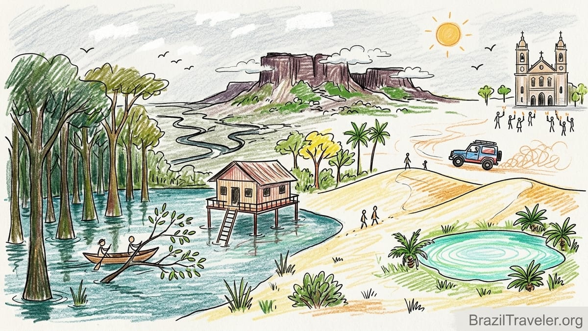
Why There Is No Single Best Month for North Brazil
On paper, the northern half of Brazil looks simple. Forecasts divide the year into a “rainy season” and a “dry season,” and tourism boards often highlight a handful of supposedly perfect months. In practice, the story is far messier. On my last circuit between Manaus, Alter do Chão, Belém and Jalapão, I stepped from flooded forest where trees stood waist deep in water straight into semi arid cerrado where dust coated the back of my throat. All of that happened within the span of two weeks.
Rivers are the main reason there is no single best month for the region. Around Manaus, the Rio Negro can swing by almost ten meters between peak flood and lowest water. Recent monitoring bulletins published in 2026 for the port of Manaus show river heights reported day by day, and those curves shift slightly each year as rainfall patterns across the western Amazon change. In some years, boats glide directly under the stilted houses of river communities; in others, the same houses sit high above muddy banks with long staircases to reach the water.
When I planned my first Amazon trip, I naively picked “July” because a guidebook called it “ideal.” The reality was more nuanced. Near Manaus, that particular July still had high water, which meant my canoe slid easily into flooded igapó forest. Two weeks later in Alter do Chão, the Tapajós River had only just begun to fall, so the famous beaches were still slim strips of sand. The month on the calendar was the same. The experiences were not.
Travelers who try to pick a single magic month for Manaus, Alter do Chão, Jalapão, Belém and Mount Roraima will always compromise on something. Instead, it helps to work backwards: decide if you want canoeing among tree trunks, wide freshwater beaches, dusty 4x4 expeditions or religious festivals, then target the season that favors that specific trip. River level charts, local agencies and even daily photos uploaded by pousadas now matter more than any generalized “best time to visit” line on a website.
Weather and River Seasons: What They Actually Feel Like
Numbers like “32 degrees Celsius” or “200 millimeters of rain” do not capture how the Amazon and the cerrado feel on your skin. Walking out of the Manaus airport in March, I remember my glasses fogging instantly. The humidity wrapped around me like plastic. Standing still felt like a workout, and a ten minute walk to a nearby hotel with a backpack turned into a soaked shirt and damp passport. Air conditioning was not a luxury, it was the only way to let my body cool down enough to sleep.
High humidity also changed the rhythm of my days. Midday city sightseeing in Manaus during the wet half of the year was punishing, so I learned to treat the hours between about eleven in the morning and three in the afternoon as siesta time. I would visit the Teatro Amazonas early, then retreat to a café with brutally strong air conditioning, only resurfacing along the riverfront as the heat softened. The locals around me carried small towels or handkerchiefs to wipe sweat. By my second trip, I did the same.
In Alter do Chão at the height of the low water season, the feel was completely different. Standing barefoot on the wide white sandbanks of Ilha do Amor in late October, the sun bounced off water and sand in all directions. The air still felt humid, but a constant breeze across the Tapajós River cut the edge. The sand was too hot to cross at midday without flip flops, so I timed beach walks for late afternoon, when food stalls set out plastic chairs directly in the water and vendors sold ice cold açaí in plastic cups for the equivalent of a few dollars.
Jalapão showed me another side of the region’s climate entirely. I joined a four day circuit from Palmas in August, exactly the period most recent guides recommend as the drier expedition window. We spent hours inside a 4x4 on unpaved roads. Each time we passed an oncoming vehicle, a cloud of fine orange dust enveloped the car, seeped through the doors and left a film over our bags and faces. My hair felt gritty by midday and my contact lenses dried out if I forgot to blink often. In the late afternoon, the same dust turned the horizon copper when the sun dropped behind the dunes.
Manaus and the Amazon: High Water vs Lower Water
Manaus is where I noticed most clearly how river levels reshape an Amazon trip from week to week. The Rio Negro’s cycle roughly divides the year into two broad experiences. Around the peak of the flood, usually between May and early July, my boat could glide into the trunks of the igapó forest. We pushed silently between dark tree trunks, the hull brushing leaves at shoulder level. Sloths stared down at us from what would normally be the upper canopy, and I could hear fish splashing among branches that would be dry ground a few months later.
During one June visit, I stayed on a simple floating lodge a few hours from Manaus. The platform rocked gently at night, tied directly to trees whose lower branches were submerged. Mosquitoes were present but surprisingly less intense than I had feared, likely because the blackwater of the Rio Negro is more acidic. Early one morning we took a canoe into a flooded channel, and the guide reached out from the boat to pick guava directly from branches over the water. This is the kind of experience that only really exists when the river is high.
I returned to the same lodge in October of another year, when water levels around Manaus had dropped substantially compared with their June peak. The trees that had been shoulder deep in water now stood on muddy banks. Instead of canoes entering the forest directly from the lodge, we walked down a long wooden staircase to reach the boats. Trails that had been underwater reappeared, and we could hike on firm ground, spotting leaf cutter ants and armadillo holes. White sandbars emerged on some stretches of the Rio Negro, and the boat occasionally grounded for a second on shallow sections the pilot knew like a map.
If I had to choose, I would personally time Manaus and the surrounding Amazon for late May or June, skewing toward the high water side without being locked into constant rain. That is when I enjoyed the contrast of flooded forest, river dolphins around Anavilhanas and still manageable afternoon storms. The mistake I made on one early trip was packing as if for a typical humid summer: cotton T shirts, one pair of sandals and a light sweater. Cotton stayed soaked for hours after boat spray or a passing shower, and my sandals turned slippery on wet wooden docks. Now I bring quick drying shirts, two pairs of footwear including one with solid grip for muddy forest paths, and a simple dry bag to throw cameras and phones into during sudden downpours.
Alter do Chão: Following the Freshwater Beaches
Alter do Chão, near Santarém, is the place that finally taught me to read river calendars before flights. The district is famous for its freshwater beaches on the Tapajós and Arapiuns rivers, and local lodges, tour companies and even international newspapers describe it as an “Amazonian Caribbean” when water is low. Official guidance from pousadas and community projects now consistently highlights August through December as the prime beach season, when the river recedes and the sandbanks of Ilha do Amor and the Arapiuns communities widen dramatically.
My first visit, in early September, caught the landscape in transition. On the main beach in front of the town, the water was already several meters below its rainy season mark, and a strip of sand large enough for a row of straw covered kiosks had appeared. However, some of the more photogenic sandbars upriver were still slim, and our boatman explained that they would be “perfect” only in October or November. We spent the day between Ponta de Cururu and local community beaches, and by late afternoon the fine sand squeaked underfoot, almost too hot to stand on without sandals.
On a later trip in late January, I returned expecting similar beaches and instead found water licking at the stairs in the town square. A Borari guide told me that in that particular year the rivers had started rising earlier, and that most of the postcard sandbars had already disappeared. Prices for simple riverfront rooms were lower than in the peak dry months, and I had no trouble finding a last minute boat trip, but the landscape was a different destination entirely. Instead of beach hopping, we focused on forest walks, birdwatching at sunrise and cheaper lunch menus in town, where dishes like grilled tambaqui and pirarucu cost noticeably less than in high season.
If river beaches are your priority, I would aim for October or early November for Alter do Chão, booking flights into Santarém with some flexibility to adjust a week either way. Before committing, I now message a couple of local guesthouses and ask them to send photos from that week. My biggest packing mistake there was underestimating sun exposure. Because the water is fresh and constantly moving, it did not feel as harsh on the skin as a tropical ocean, so I delayed reapplying sunscreen. By the end of the first afternoon, my shoulders were pink despite using a reputable high factor brand. On my next visit, I brought a thin long sleeved UV shirt and a wide brimmed hat and wore them even while wading waist deep to the beach bars.
Jalapão: Dust, 4x4 Tracks and the Drier Expedition Window
Jalapão, in the state of Tocantins, sits outside the rainforest, in a mosaic of cerrado savanna, rock formations and bright sand dunes. Here, water still matters, but in the form of road conditions rather than river cruises. Most current tourism material, as well as local operators based in Palmas, recommend May through September as the best window for overland expeditions. This is when rainfall is lower, dirt roads dry out and access to attractions like the Jalapão dunes, the Formiga waterfall and the crystal clear fervedouros is more reliable.
I joined a shared 4x4 tour in August, leaving Palmas before dawn. The first hours on paved highway were gentle. Once we turned onto unsealed roads, the character of the trip changed entirely. The vehicle bounced along corrugated orange tracks, and each window crack let in a trickle of dust. We stopped at a basic roadside restaurant for lunch, where a buffet of rice, beans, grilled meat and salad cost the equivalent of a mid range urban café drink back home. Every traveler there looked the same: sunglasses pushed up on dusty hair, clothes tinged orange and smiles widened by the shared adventure.
In camp, nights were much cooler than I expected. I had packed for hot days and brought only a light sleep sheet, assuming anything more would be overkill in the Brazilian interior. Instead, temperatures dropped enough that I woke at three in the morning and layered every T shirt I owned. The next night, I borrowed a thin blanket from the driver, who laughed kindly and said that people think “Brazil is always hot” until they visit the cerrado in the dry season.
If I were planning Jalapão again, I would still choose late dry season for the clearer skies and more predictable roads, but I would pack a thin fleece and a buff or bandana to protect my mouth and nose from dust during long transfers. Travel agencies in Palmas often prefer at least four days to cover main highlights without rushing, and recent price checks show that group departures with local companies tend to include all meals and accommodation, which helps with budgeting because there are very few independent lodging options once you leave the paved road network.
Belém and the Círio: Heat, Crowds and Calendar Math
Belém’s climate is consistently hot and humid, but the mood of the city changes dramatically around the Círio de Nazaré, one of the most important religious events in Brazil. The festival has been formally set for the second Sunday of October for over a century, and the 2026 edition follows that same pattern. In practice, the city’s energy ramps up well before that date, with novenas, smaller processions and related ceremonies filling the calendar in late September and early October.
I timed one visit to Belém to coincide with the Círio, arriving three days before the main Sunday procession. From the moment I stepped out near the Basílica de Nazaré, the density of people, candles, food stalls and music felt closer to a major concert than to a typical religious service. The heat multiplied in the crowd. Standing shoulder to shoulder with thousands of pilgrims, I felt sweat run down my back within minutes, even though it was still early morning. Vendors passed by constantly selling bottled water, cups of caldo de cana and local snacks like tapioca pancakes and fried fish.
On one afternoon procession that week, dark clouds rolled in without warning. The air cooled slightly, and then a tropical downpour turned the avenue into a shallow stream. Locals pulled plastic ponchos from pockets and kept walking. I had brought only a thin cotton rain jacket, which soaked through in seconds and clung coldly to my arms. The festival continued regardless. Drums echoed off wet asphalt and the rope that surrounds the saint’s carriage remained packed with devotees, now drenched and singing louder to drown the rain.
For travelers, the choice is between this intense, crowded and deeply moving October experience and a calmer visit at another time of year. I would personally choose to see Belém at least once during the Círio, even if only for a few days, and then return in another month for easier museum visits and Amazon estuary day trips. If you plan to attend in 2026, book rooms months ahead, as official festival materials already circulate widely and Belém’s mid range hotels and guesthouses fill quickly for that weekend. Pack light clothing that dries fast, a compact poncho instead of a heavy jacket and footwear that can handle ankle deep water on city streets.
Mount Roraima: Trekking Above the Clouds
Mount Roraima sits on the border between Brazil, Venezuela and Guyana, and most treks access its tabletop plateau from the Venezuelan side with logistical support arranged in Brazil or via regional operators. Unlike Manaus or Alter do Chão, this is a highland environment. Heat and humidity still matter on the approach hike, but on top of the tepui rain, mist and cold nights dominate. Planning here is about choosing between wetter months when waterfalls surge and drier months when trails and campsites are less muddy.
When I joined a week long trek to Mount Roraima, the operator had suggested a window between December and March as a relative dry season, while warning that weather is unpredictable year round. We began under a clear blue sky, hiking through savanna grassland with distant views of the sheer rock walls in front of us. By the time we reached the first camp, clouds had swallowed the summit. A few hours later, a cold rain arrived that made me grateful for the full waterproof shell I had almost decided to leave at home.
On the ascent day, we climbed in a steady drizzle, crossing small streams and sections of slippery rock. The humidity meant I still sweated heavily while hiking, but as soon as we stopped for a snack, the wind on the exposed path cooled me rapidly. At the top, campsites under rock overhangs felt damp. I wore a light down jacket every evening, not because the air temperature was dramatically low by alpine standards, but because everything I owned was slightly wet. A fellow trekker who had packed only a flimsy windbreaker shivered through dinner and slept in several layers of borrowed clothes.
If your priority is clearer views and less mud, I would aim for the traditionally drier months recommended by experienced operators and be prepared for some rain regardless. For more dramatic waterfalls and mist effects above the cliffs, a window closer to the wetter part of the year can be rewarding, accepting that gear and boots will remain soggy. In both cases, I would change two things from my first trip: carry one full set of dry base layers in a waterproof bag reserved only for camp, and bring trekking poles to help on slippery sections of the trail. Temperatures can feel surprisingly cold at night compared with the lowland Amazon, so a warm hat and gloves, even in northern Brazil, earned their place in my pack.
How I Plan and Pack Now: Lessons From Mistakes
After multiple loops through North Brazil, I no longer ask “What month is best?” I ask more specific questions instead. For Manaus and the central Amazon, I look up current river level charts for the Rio Negro, which are updated daily by port authorities, and then I email jungle lodges directly to ask how that translates to their activities. When I wanted more canoeing between tree trunks, I aimed for a high water reading similar to the 2021 flood peaks cited in recent municipal planning documents. When I cared more about hiking and sandbars, I watched for reports of lower than average levels.
For Alter do Chão, I cross check several local sources that now publish month by month breakdowns. Community run lodges and riverside hotels circulate calendars that describe beach season roughly from August into January, with October and November often highlighted as the widest sand period. Brazilian travel writers also increasingly highlight the “winter” high water months as an opportunity to visit with fewer crowds and lower room rates, trading classic postcard beaches for canoeing in flooded forest and birdlife closer to town. I decide between those two versions of the destination each time I go.
In Jalapão, my planning is almost entirely about road conditions. Local operators based in Palmas and Mateiros know which sections of track turn to mud in heavy rain and which bridges wash out. They confirm that May to September gives the best chance of dry, passable roads, but they also warn that even in this window a sudden storm can make a track slippery for a day. I accept that part of the adventure and build an extra night into my itinerary so that a washed out bridge or a broken suspension does not cascade into missed flights.
Belém and Mount Roraima demand calendar math rather than river charts. For Belém, I count to the second Sunday in October if I want the Círio and consider arriving a week early if I hope to catch quieter rehearsals and smaller processions while still finding hotel rooms at something closer to usual rates. For Roraima, I listen carefully to operators who have run the route for years and adjust based on political and logistical realities as well as the sky. In all of these places, my packing has become lighter and more focused: fewer cotton pieces, more quick drying fabrics, a compact poncho, a breathable sun hoody, serious sunscreen, and one warm layer even when the forecast says “tropical.”
The Takeaway
North Brazil rewards travelers who time their trips like locals rather than like brochure writers. There is no universal best month that suits Manaus, Alter do Chão, Jalapão, Belém and Mount Roraima at once. The same October that gives perfect beaches on the Tapajós might bring muddy trails on a tepui or crowded Círio streets in Belém. A high river in June can turn Manaus into a flooded forest paradise while still leaving Jalapão’s roads dry and dusty.
If there is a single rule, it is to decide first what kind of trip you want, then build your dates around that. For flooded forest and easy canoe access in the Amazon, aim for the higher water months and verify river levels week by week before you fly. For freshwater beaches, slide into Alter do Chão in the heart of its low water season and double check with guesthouses about how wide the sand banks really are this year. For Jalapão, prioritize the dry road window and pack for dust and chilly nights. For Belém, choose between the intense emotion of the Círio in October and a calmer visit, and for Mount Roraima, balance clearer skies against the thrill and discomfort of wetter waterfalls and muddy trails.
My own ideal loop today would probably start in late May or June with a week on the Rio Negro near Manaus, continue to Alter do Chão in October for full beaches, fit Jalapão into August for drier roads, drop into Belém around the Círio at least once in life, and leave Mount Roraima for a separate focused trek when work and politics align. The order may shift, and climate patterns will continue to evolve, but one truth holds: in North Brazil, water levels, clouds and dust matter more than page one of the calendar.
FAQ
Q1. Is there a single best month to visit North Brazil?
There is no single best month, because Manaus, Alter do Chão, Jalapão, Belém and Mount Roraima each follow different rainfall and river cycles that peak at different times of year.
Q2. When is the best time to see flooded forest near Manaus?
If you want to canoe among tree trunks and stay at floating lodges, target the high water months around May to early July and confirm exact river levels shortly before your trip.
Q3. When should I go to Alter do Chão for the widest river beaches?
Local guidance favors the low water season from about August to January, with October and November often offering the broadest sandbanks and classic “Amazonian Caribbean” landscapes.
Q4. What months are recommended for Jalapão road trips?
Most regional operators recommend May through September for Jalapão, when rainfall is lower, dirt roads are firmer and access to dunes, waterfalls and fervedouros is more reliable.
Q5. How hot and humid does it really feel in Manaus?
Expect heavy humidity that can fog glasses and camera lenses, with daytime temperatures that make midday walking exhausting; plan activities early and late in the day and favor quick drying clothing.
Q6. When should I visit Belém if I want to experience the Círio de Nazaré?
The main Círio procession takes place on the second Sunday of October, and the city fills with related events in the preceding days, so plan to arrive at least several days before that weekend.
Q7. What is the best season for trekking on Mount Roraima?
Experienced operators often recommend a relatively drier window between roughly December and March for fewer muddy trails, while still warning that rain and mist are possible year round.
Q8. Do I need special clothing for Jalapão’s dust and temperature changes?
It is wise to pack a light fleece or jacket for cool nights, a buff or bandana to filter dust on long 4x4 transfers, and sunglasses that you do not mind coating in fine orange grit.
Q9. How far in advance should I book accommodation for the Círio in Belém?
For the October Círio weekend it is safest to secure central hotels or guesthouses several months in advance, as many options sell out once the festival calendar circulates locally.
Q10. What are the most important items to pack for a multi stop trip through North Brazil?
Bring quick drying clothing, serious sun protection, a compact poncho, footwear that grips on wet and muddy surfaces, at least one warm layer for cooler nights and a dry bag for electronics during sudden downpours.