


I had imagined Serra do Rio do Rastro as a postcard curve caught from a drone shot. Instead, I found a living mountain road that demanded attention every second, with fog rolling over basalt cliffs, trucks crawling around hairpins and wind shaking the car at 1,400 meters. This is what it was really like to drive Santa Catarina’s most talked-about road, and what I wish I had known before putting SC-390 into the GPS.
Key Facts From My Own Drive
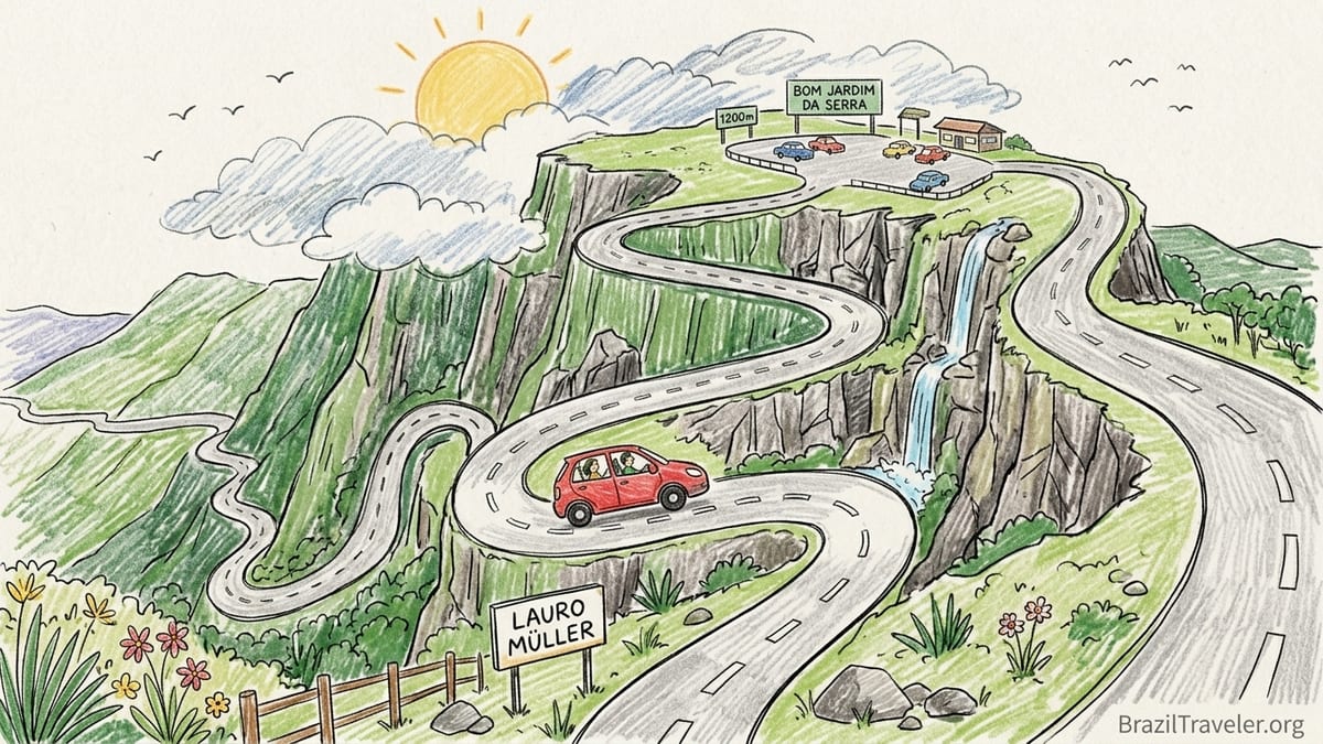
I drove Serra do Rio do Rastro in October 2026, on a weekday morning, sitting in the passenger seat while a local professional driver took the wheel. We started in Lauro Müller, at the base of the mountain in the coastal lowlands, and climbed the famous sequence of switchbacks to the upper lookout in Bom Jardim da Serra. Our vehicle was a compact flex-fuel hatchback with 1.0 engine and front-wheel drive, the type that rental agencies at Florianópolis and Criciúma airports often classify as economy. I recorded the route, weather forecast, driving time and fuel use precisely to understand how this road feels in real conditions.
Before leaving Lauro Müller, I checked a local status service that aggregates official bulletins and user reports for Serra do Rio do Rastro. On the date of my trip, SC-390 was listed as open, with a caution about fog and occasional rockfall near the upper curves. The meteorological forecast for that morning predicted low cloud, temperatures between 10 and 15 degrees Celsius, light drizzle at altitude and gusty winds on the plateau. On the valley floor, though, it still felt like mild spring.
From the center of Lauro Müller to the first serious uphill hairpins took about 15 minutes at normal traffic speeds. From the base of the main climb up to the official mirante near Bom Jardim da Serra, our ascent lasted roughly 35 minutes, including one short pause in a safe pull-off area used by maintenance vehicles. The total time door to door from Lauro Müller to the lookout parking area was just under one hour. On the descent later in the day, following the same route down, the steep grades and need for engine braking actually made us slower. It took close to 45 minutes from the lookout back to the lower section where the serra straightens and speeds increase again.
In terms of fuel, our small flex car consumed a little under 4 liters for the full round trip between Lauro Müller and the Bom Jardim da Serra plateau, combining the mountain section with a short stretch of rolling highlands. At October 2026 gasoline prices in Santa Catarina, this worked out to roughly 30 to 40 reais in fuel for the serra portion of the journey. Parking at the main lookout area on the plateau was informal and did not carry a posted fee on the day I visited, though some roadside cafes closer to Bom Jardim da Serra ask non-customers for a small contribution to use their lots.
Uphill Versus Downhill: Two Very Different Drives
Climbing Serra do Rio do Rastro from Lauro Müller is intense but predictable if the road is dry and visibility is reasonable. The gradients are steep, often near the upper range of what a paved mountain road can manage, and the switchbacks are genuinely tight. Our driver approached the ascent in second gear for most of the central hairpin sequence, occasionally dropping to first on the sharpest corners, especially when we were forced to slow behind tourist vans. Once you commit to a bend, there is very little room to correct a bad line, and almost no shoulder to absorb mistakes.
Traffic volume changes the character of the road completely. On my October weekday, we encountered several heavy trucks hauling goods between the highlands and the coast. Passing opportunities were rare, since straight stretches are short and often blind. When we did overtake, it was only in clearly designated sections with full visibility ahead, and always at the urging of our experienced driver, not my instinct as a visitor. The uphill driver’s challenge is to manage engine power and temperature while keeping distance from slower vehicles, ready to stop if a bus appears mid-corner from the opposite direction.
Descending later that afternoon proved more psychologically demanding. Even with a professional at the wheel, I felt the car’s weight pushing into each bend, the guardrails uncomfortably close and the valley suddenly very far below. Our driver relied heavily on engine braking, keeping the gearbox in second and occasionally first, and touching the brakes only to trim speed before entry into the tightest hairpins. He repeatedly mentioned that inexperienced drivers often overuse the brakes here, risking fade and unwanted heating on long downhill stretches. Going down, we moved slower than on the way up, especially when the road surface was still damp from passing showers.
For nervous passengers, the descent can feel like a series of exposure tests. There are several points where the outer edge of the road seems to hang directly above empty space, and the absence of wide shoulders means that even a cautious maneuver such as letting a faster car pass must wait for one of the rare wider bays. If you are driving yourself, I would strongly recommend assigning the steepest section to the daylight hours when visibility is at its best and committing to a calm, uninterrupted descent without sudden stops for photographs.
Seeing the Famous Curves From Above and From Below
The classic postcard of Serra do Rio do Rastro is taken from near the upper mirante, a viewpoint on the Bom Jardim da Serra side that looks down across the entire cascade of asphalt. In person, this view is still spectacular, but more complex than most promotional images suggest. On my visit, the valley below was partly filled with cloud, so that some of the lower curves appeared and disappeared as the fog shifted. The rock walls around the upper bends showed distinct horizontal layers, a reminder that the road cuts across a column of volcanic and sedimentary rocks that geologists have studied for over a century.
From the mirante, the hairpins look almost toy-like, a pale ribbon twisting among green vertical slopes and small waterfalls. It is a panoramic vantage point and a safe one, with solid barriers separating visitors from the drop. Cafes and small souvenir stands cluster nearby on the plateau, and the scene feels almost like an organized viewpoint in the Alps. However, the noise of truck engines climbing in low gear below and the sight of buses negotiating blind turns remind you that this is an active transport corridor, not a theme-park road closed for scenic drives.
Looking up from the Lauro Müller side is a very different experience. Before you reach the base of the main climb, there are spots where you can see the entire escarpment ahead, a nearly vertical wall of forested rock crossed by a faint zigzag of pavement. On the morning of my drive, the top section was hidden by a lid of cloud, and only the lowest half of the road was visible. The impression from below is less postcard and more challenge. You sense the climb as a gateway between two distinct worlds: the humid coastal lowland and the cooler high plateau where Bom Jardim da Serra sits more than 1,200 meters above sea level.
Inside the car, the visual drama shifts into something more intimate. Many of the tightest corners are hemmed in by rock on one side and protective barriers on the other, so you often see only a wall of basalt or a small slice of sky. Occasionally, the view opens suddenly across a clearing or a cut in the vegetation, revealing the valley floor far below. At these points, my driver refused any idea of stopping on the roadway itself, insisting that we keep moving until we reached a proper pull-off or the mirante complex at the top.
Weather, Fog and Seasonal Ice
The forecast for my October visit suggested a typical shoulder-season pattern for the Serra catarinense. Temperatures at the plateau hovered in the low teens Celsius, while Lauro Müller on the coastal side was several degrees warmer. What the forecast could not fully convey was how dynamic the fog would be. On the first half of our ascent, visibility remained manageable, around several hundred meters with only light low cloud. Near the upper third, however, the fog thickened rapidly. At times the car’s headlights illuminated a white wall less than 30 meters ahead, and our speed dropped to well under 30 kilometers per hour through certain bends.
These quickly changing conditions make it essential to check not only general weather reports, but also specific road alerts on the same day as your drive. Local advisories often mention temporary closures for maintenance, landslides after heavy rain or restrictions on heavy vehicles. In the weeks before my trip, there had been short-term nighttime closures for engineering works along parts of SC-390, reinforcing that this is an evolving road with ongoing safety interventions. October is usually outside the harshest winter period, but even then I was told by locals at the plateau that overnight frost can still appear in shaded sections after cold fronts.
Winter in Bom Jardim da Serra and Urubici can bring sub-zero temperatures, hard frosts and occasional snowfalls. Accommodation sites and regional tourism authorities emphasize that, on very cold mornings, black ice may form on the most sheltered hairpins and drainage points. In those conditions, authorities sometimes restrict access or advise against driving during early hours. While ice was not present on the day of my visit, residual damp and leaves made some sections slippery enough that our driver took a conservative line through most corners.
Wind was another factor I did not fully anticipate. Once we reached the plateau near the main lookout, gusts swept across the open highlands strong enough to rock the parked car slightly. Standing by the mirante railing, I saw mist moving rapidly across the escarpment like waves, alternately revealing and hiding the valley road. Photographs from that position can look serene, but the wind chill and instability underfoot encouraged most visitors, myself included, to limit their time near exposed edges and to keep children close at all times.
Bom Jardim da Serra Highlands, Rural Stays and Urubici
Serra do Rio do Rastro is more than a dramatic link between a lowland town and a highland lookout. At the top, the road continues inland across the plateau to Bom Jardim da Serra, a small mountain municipality that promotes itself as a gateway to canyons, waterfalls and rural tourism. The town sits at around 1,200 meters, which explains why it is one of the coldest inhabited areas in Brazil. From the mirante area to the center of Bom Jardim da Serra, the drive took us about 20 minutes over gently rolling terrain with scattered farms and patches of araucaria forest.
Bom Jardim da Serra has a growing range of accommodation. On recent checks, basic pousadas in town quoted nightly double-room rates starting around 180 to 250 reais in the low season, while rural chalets and boutique hotel-fazendas on the plateau advertised prices more in the 400 to 800 reais range per night for couples, including breakfast. One rural property near Bom Jardim da Serra highlighted its altitude and winter conditions, mentioning frequent frost and, in some years, light snowfall. These stays appeal to travelers who want more than a quick photo stop, offering horse riding, small lakes, wood-fired stoves and, in some cases, on-site restaurants showcasing local trout and hearty mountain dishes.
Urubici, another major mountain town in the region, lies further inland. Depending on the exact route and road conditions, distances between Bom Jardim da Serra and Urubici range from roughly 80 to just over 100 kilometers, with driving times typically between 1.5 and 2 hours each way. Urubici itself is a destination with enough viewpoints, waterfalls and hiking routes to fill several days, including Morro da Igreja, Pedra Furada and nearby canyons. It is perfectly possible to combine Serra do Rio do Rastro and Urubici in a single trip, but not comfortably in one rushed afternoon if you hope to explore both beyond the parking lots.
What my day on the road underlined is that every additional stop in this region comes with real time and distance costs. Leaving Lauro Müller in the morning, climbing to the mirante, continuing to Bom Jardim da Serra for lunch, then pressing on to Urubici and trying to return to the coast the same evening would involve many hours of driving on secondary roads, often in variable weather and with limited overtaking options. That is why most local guides and pousada owners recommend at least one overnight stay in the highlands. A realistic itinerary is to base yourself in Bom Jardim da Serra or Urubici for two or more nights, dedicating one clear morning or afternoon specifically to Serra do Rio do Rastro.
Guided Excursions, Driving Costs and Who This Road Is For
For travelers who are uncertain about tackling SC-390 themselves, there are two main options. The first is to rent a car in Florianópolis, Criciúma or another regional hub and drive personally, treating Serra do Rio do Rastro as part of a larger road trip across Santa Catarina. Daily rates for a small manual hatchback in October 2026, checked across several national rental brands, often started in the band of 130 to 200 reais per day before insurance and fuel, increasing on peak weekends or holidays. Fuel costs for including Serra do Rio do Rastro in a longer loop that might also cover Urubici and surrounding attractions typically add several hundred reais more, depending on distances and the chosen vehicle.
The second option is to book a guided excursion or private transfer that specifically includes the serra. From coastal cities such as Criciúma or even from Florianópolis, agencies advertise day trips or two-day packages to the Serra Catarinense region. Prices vary widely, but as a broad reference in late 2026, I saw group excursions in standard vans from the coast to the highlands, including Serra do Rio do Rastro and selected viewpoints, starting around 350 to 550 reais per person for long full-day itineraries. Private drivers, often using SUVs or more comfortable sedans, tended to quote 900 to 1,500 reais for a bespoke day that combined Serra do Rio do Rastro with Bom Jardim da Serra or Urubici, fuel and tolls included but lodging extra.
Because I chose to travel with a local driver familiar with every bend, I was able to focus on observing conditions rather than managing the gearbox. Sitting in the front passenger seat allowed me to feel how often he downshifted before corners, how conservatively he approached damp patches, and how he communicated through headlights and subtle hand gestures with oncoming trucks. I came away convinced that, while a confident driver used to mountain roads can manage Serra do Rio do Rastro carefully, this is not an ideal environment for someone whose experience is limited to urban traffic or flat highways.
For anxious passengers and families with young children, the decision is more delicate. The combination of exposure, narrow roadway and the constant sense of height can be stressful. I noticed several children at the mirante who enjoyed the cold wind and views but became uneasy when looking over the railing. Inside the car, some hairpins give the impression of driving directly into the sky or over a precipice before the next curve appears. If anyone in your group suffers from vertigo or panic in such situations, consider allocating them to a middle seat away from window edges or even having them skip the steepest section by waiting at a café on the plateau while others drive only a short portion of the descent and return.
Safety, Stops and Realistic Expectations
Many of the most viewed videos of Serra do Rio do Rastro show cars or motorcycles stopping mid-curve, drones flying just above moving vehicles and people photographed standing close to the road edge. On my drive, local attitudes were more restrained. Our professional driver was clear that stopping on the narrow carriageway just to take pictures is both illegal and genuinely dangerous, given the limited visibility around many bends and the presence of heavy vehicles that need the full arc of the lane to maneuver. The safest places to stop and absorb the landscape are the structured lookout areas at the top and a few wider bays or small mirantes signposted along the plateau side, away from the tightest series of curves.
At the main mirante on the Bom Jardim da Serra side, basic facilities included restrooms, small snack bars and stalls selling hot drinks, simple meals and local products such as honey and pine-nut pastries in season. During my visit, a typical snack and coffee for two people cost around 40 to 50 reais, with more complete lunches in Bom Jardim da Serra’s modest restaurants and hotel-fazendas ranging from 50 to 90 reais per person depending on whether buffet or à la carte options were chosen. Prices increase during winter weekends and July school holidays, when the region receives visitors hoping for frost or even snowfall.
Night driving is technically possible along Serra do Rio do Rastro, and trucks use the route around the clock, but nothing in my experience or in conversations with residents suggested that visitors should plan their first crossing after dark. Fog, rain and headlights reflecting on damp surfaces dramatically reduce reaction time. The lack of continuous lighting along much of the climb and the risk of encountering animals on the road, particularly in rural stretches near the plateau, add further complications. My own drive finished well before sunset, and if I return, I will again schedule the full ascent and descent in broad daylight.
Expect also that weather may simply refuse to cooperate with your plans. Several locals shared stories of travelers who arrived to find the entire serra blanketed in cloud for days, seeing nothing of the famed curves from the lookout. A regular visitor I met at a café in Bom Jardim da Serra mentioned that he had driven the road in blazing sunshine, dense fog, wind-driven rain and even light snow on different trips, and that the only constant had been the need for patience and respect for the mountain. In this sense, Serra do Rio do Rastro is not just an attraction to be checked off but a route that occasionally decides whether you will see it or not.
The Takeaway
Looking back on my October 2026 journey over Serra do Rio do Rastro, the most memorable stretch was not the classic postcard view itself, but a mid-mountain sequence of curves where the fog thinned just enough to reveal layers of valley and rock through shifting gaps. The combination of engine note, damp asphalt, dripping vegetation and glimpses of the world far below captured the essence of the road more powerfully than any single lookout photograph. It felt both exposed and strangely intimate, as if we were threading a narrow passage between weather and stone.
Far from spoiling the experience, the fog actually enhanced it for me. The changing visibility forced us to slow down, which in turn allowed more time to absorb the textures of the cliffs, the tiny waterfalls and the sparse roadside flora clinging to the basalt. Clear blue-sky days certainly produce cleaner photographs of the entire zigzag, but the moody conditions I encountered made the drive feel like a narrative rather than a static panorama. That said, for a first-time visitor hoping for the iconic full view, it would make sense to allow two potential mornings in the region so that at least one may offer better clarity.
If I could choose my direction next time, I would again start in Lauro Müller and climb toward Bom Jardim da Serra, then continue across the plateau for a night or two in the highlands, ideally combining the serra with a stay at a rural pousada near Bom Jardim da Serra or a small lodge around Urubici. Driving uphill first felt intuitively safer, since the car worked against gravity, and reaching the plateau gave a psychological reward at the end of the hardest segment. Descending later in daylight, after resting and perhaps exploring local waterfalls or viewpoints, would let me approach the steep side with more familiarity.
Is Serra do Rio do Rastro worth a special overnight detour rather than a long day trip? After experiencing the gradients, the weather swings and the distances between Bom Jardim da Serra, Urubici and the coastal cities, my answer is yes. Treating the serra as a quick “there and back” from the coast compresses driving, reduces your margin for delays caused by fog or maintenance and tempts rushed decisions on a challenging mountain road. Building at least one, and preferably two, nights into a highland itinerary transforms the experience. You gain the flexibility to wait for better conditions, to see the escarpment from both directions and to appreciate that Serra do Rio do Rastro is not only a famous Brazilian postcard, but also a working road that still shapes how the coast and plateau connect.
FAQ
Q1. Who actually drove the Serra do Rio do Rastro in this account?
On this trip, a local professional driver familiar with SC-390 drove the car, while I traveled in the front passenger seat and documented timings, conditions and impressions.
Q2. How long does it take to drive up and down Serra do Rio do Rastro?
From Lauro Müller to the main lookout near Bom Jardim da Serra, our uphill ascent through the steepest curves took about 35 minutes, within a total of roughly one hour from town center to mirante. The downhill run from the lookout back to the lower slopes took slightly longer, close to 45 minutes, due to engine braking and caution on damp bends.
Q3. Is Serra do Rio do Rastro suitable for inexperienced drivers?
It is a paved but demanding mountain road with steep grades, tight hairpins, limited overtaking and frequent trucks. Confident drivers used to mountain conditions can manage it carefully, but for those with little experience beyond cities or flat highways, hiring a local driver or joining a guided excursion is a safer and less stressful choice.
Q4. What is the best direction to drive, uphill or downhill?
Starting in Lauro Müller and climbing toward Bom Jardim da Serra generally feels more controlled, since the car works against gravity. Descending later in daylight, after you are familiar with the curves, reduces surprise and allows you to plan your gear changes and braking. Many visitors, myself included, find the uphill direction less intimidating than descending first.
Q5. How far are Bom Jardim da Serra and Urubici from the serra lookout?
From the main mirante at the top of Serra do Rio do Rastro, Bom Jardim da Serra town is around 20 minutes’ drive across the plateau. Urubici lies significantly further inland, roughly 80 to a little over 100 kilometers away depending on route, which usually means 1.5 to 2 hours of additional driving in each direction.
Q6. What kind of weather should drivers expect on Serra do Rio do Rastro?
Conditions shift quickly. Even in October, I encountered moving fog banks, drizzle near the top and strong winds on the plateau, while the valley remained milder. In winter, Bom Jardim da Serra and Urubici can experience sub-zero temperatures, heavy frost and occasional snowfall, with the risk of black ice in shaded hairpins. It is essential to check same-day road alerts and weather forecasts before driving.
Q7. Are there fees for parking and lookouts on the plateau?
On the day of my visit, parking at the main lookout area at the top of Serra do Rio do Rastro did not carry a posted fee. Some nearby roadside establishments on the plateau ask non-customers for a small payment to use their private lots. Food, hot drinks and souvenirs at or near the mirante are an extra cost, and lunch in Bom Jardim da Serra’s simple restaurants typically ranged from about 50 to 90 reais per person.
Q8. How much does accommodation cost around Serra do Rio do Rastro?
Recent checks showed basic pousadas in Bom Jardim da Serra town quoting double rooms starting in the 180 to 250 reais range on quieter dates. Rural chalets and hotel-fazendas with more facilities and scenic settings on the plateau often charge between 400 and 800 reais per couple per night, including breakfast, with higher prices during winter and holidays.
Q9. Is Serra do Rio do Rastro safe for families with children?
The road itself is engineered and in regular use, but exposure, narrow curves and variable weather demand caution. Families should avoid stopping on the roadway, keep children close at fenced lookouts and prioritize driving in daylight. Many families travel safely over the serra each year, but a conservative approach to speed, stops and scheduling is essential.
Q10. Is Serra do Rio do Rastro worth planning an overnight detour?
Yes. Because of the steep grades, changing weather and real distances between Lauro Müller, Bom Jardim da Serra and Urubici, an overnight or two in the highlands makes the experience more relaxed and safer. It allows time to wait out fog, see the escarpment from both directions and explore nearby rural landscapes instead of rushing through a long, tiring day trip.