


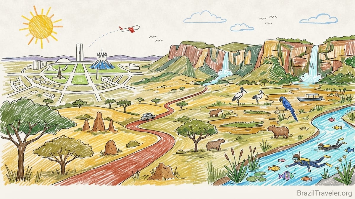
When I finally flew into Brasília and began a long loop across Central-West Brazil, I thought I was signing up for one big nature trip. I pictured waterfalls, jaguars and hot springs flowing into one another on a single, easy circuit. What I found instead were four very different worlds in four neighboring states, stitched together by long, dry roads, surprising airport logistics and a climate that punished every packing mistake I made. This is the trip that taught me to respect distance on the Brazilian map, and to treat Brasília, Goiás, Mato Grosso and Mato Grosso do Sul as separate journeys that can be combined, but never rushed.
Landing in Brasília: The Hub That Does Not Feel Like Nature Yet
My Central-West trip started, and later ended, at Brasília International Airport, officially Aeroporto Internacional de Brasília Presidente Juscelino Kubitschek. From the air the city looks like a concrete bird, all straight lines and symmetry. On the ground, the airport is a modern hub with two main concourses handling a dense web of domestic flights. I used it as a base to fan out into the region: one flight down to Campo Grande in Mato Grosso do Sul, another up to Cuiabá in Mato Grosso, with a road loop into Goiás in between.
Arriving from São Paulo, my first surprise was how dry the air felt as soon as I stepped off the plane. Brasília sits on a high plateau, and when I visited in August, the humidity hovered low enough that my nose and lips cracked after a single day. Inside the terminal the air conditioning muted it a little, but as soon as I walked outside to the taxi rank there was that particular Cerrado dryness, almost dusty even without wind. I was glad I had packed nasal spray and heavy moisturizer, something I usually reserve for winter trips, not for a place that hits around 28 to 30 degrees Celsius in the dry season afternoons.
I stayed near the Eixo Monumental rather than at the airport hotels, because I wanted at least one evening to see the Esplanada dos Ministérios lit up in orange light. That decision made sense for the city experience, but it added real time to my airport days. With Brasília’s broad avenues and underpasses, the drive between the center and the airport regularly took 25 to 35 minutes by app-based taxi, even outside rush hour. On my last morning, when I had an early flight to Cuiabá, I left with what felt like an exaggerated buffer and still arrived at check-in with less time than I liked.
Brasília itself did not feel like a nature destination to me. It felt like an engineered capital in the middle of a savanna, slightly surreal in its order. That contrast matters for planning. The city works very well as a logistics hub to reach the Cerrado in Goiás or to connect to the Pantanal and Bonito, but you do not step off a plane and onto a trail. You step into a planned city, then into a rental car or onto a highway and start earning your waterfalls.
Brasília to Chapada dos Veadeiros: The Road That Looked Short on the Map
I underestimated my first leg, from Brasília to Chapada dos Veadeiros in Goiás. On paper it looked like a simple 220 kilometer drive along the BR-010 and GO-118 to Alto Paraíso de Goiás. Distances in Brazil always read shorter in numbers than they feel in real life, and this road was no exception. I picked up a compact rental car at Brasília airport, thinking primarily about city traffic and saving on fuel. It coped, but had I known the length of the drive and the number of trucks using that route, I would have chosen something a little more powerful and comfortable.
Leaving Brasília on the BR-010, the first hour felt quick. Multiple lanes, good asphalt, clear signage. After Planaltina, when the highway tapered and became the GO-118 corridor into the Chapada, the drive slowed. The scenery shifted from scattered suburbs to a wide-open Cerrado savanna, with scrubby trees, squat termite mounds and long, rolling horizons. In August, the fields were a faded gold, and the sky was a dry, almost glaring blue. The road was paved and, at the time I went, in decent condition, but there were enough potholes and patched sections that I held the steering wheel with both hands the whole time.
It ended up taking close to four hours to reach Alto Paraíso, including one fuel stop at São Gabriel de Goiás and another quick break for coffee at a roadside posto. Google Maps had promised less, but the combination of slower trucks on inclines, occasional road work and my own need to stop for water added up. That was my first big lesson in Central-West Brazil: any transfer that looks like three hours on the map is going to eat most of a day in reality, especially if you are not used to driving long, straight highways under fierce sun.
Staying in Alto Paraíso put me a 10 to 40 kilometer drive from many of the waterfalls and private reserves around Chapada dos Veadeiros. Mornings started early, not for romance but for temperature. At 7 a.m. in the dry season it was pleasantly cool, but by midday the heat on exposed trails became aggressive. The park access roads ranged from well-graded dirt to washboard red dust that found its way into every seam of my backpack. I had packed trail runners and one pair of sandals, but I wished for lightweight gaiters and an extra pair of long pants; by day four my clothes were permanently tinted with red Cerrado soil.
Chapada dos Veadeiros vs Caldas Novas: Two Faces of Goiás
What surprised me most in Goiás was how different Chapada dos Veadeiros felt compared with Caldas Novas and Rio Quente. In the north, at Alto Paraíso and the village of São Jorge, I found a low-key, backpacker-flavored base with pousadas tucked along quiet streets, small vegetarian restaurants and a rhythm built around hiking and waterfalls. Trails into the national park and surrounding private properties led through dry Cerrado scrub to cold, clear rivers and falls. Swimming in August meant bracing water that left my teeth chattering if I stayed in too long, a sharp contrast to the hot air on the walk back to the trailhead.
South of Goiânia, Caldas Novas and Rio Quente were the opposite. After hours of driving again, I found a thermal resort town where entire hotels are oriented around soaking in warm pools. Caldas Novas sits near the Caldas Novas State Park and taps into hydrothermal aquifers that feed dozens of hotel pools and dedicated water parks. Walking through town, steam curled off blue-tiled pools at night while families migrated between buffets and slides. Unlike the rustic base of São Jorge, Caldas Novas felt like a compact, vertical resort city, with high-rise condominiums, neon signage and loud music echoing from pool decks.
I spent a day at a thermal water park on the outskirts of Caldas Novas, where a lazy river wound under palm trees and a wave pool pulsed on a schedule, all fed with naturally warm water. Even in the dry season the region’s climate made the heat on the pavement intense by midday. Flip-flops became essential to avoid burning my feet on the way between pools. The park opened from mid-morning to late afternoon, and by arriving close to opening time I managed to secure a shady lounge chair. Food and drink were sold using a wristband system, and my receipts at the end of the day had climbed faster than expected, especially for snacks and caipirinhas.
Driving between these two Goiás personalities was an education in planning. The distance between Brasília, Alto Paraíso and Caldas Novas is manageable in isolation, but trying to link Chapada dos Veadeiros and Caldas Novas in a single, tight itinerary would mean sacrificing actual time in waterfalls or hot springs for more hours behind the wheel. In hindsight, I preferred dedicating a separate segment of the trip to each: a rougher, dustier phase in the north based around hiking, and a softer, sleepier phase in the south based around warm water and evenings in hotel robes.
Into Mato Grosso: Cuiabá, Chapada dos Guimarães and the Edge of the Pantanal
Flying from Brasília to Cuiabá in Mato Grosso underlined again how Central-West Brazil is not a single destination. The plane crossed a patchwork of agricultural fields and fragments of native vegetation, and when we landed at Cuiabá’s airport, the humidity hit me again. Unlike dry Brasília, Cuiabá felt heavier in the air, with heat that clung to the skin even at night. The airport itself was smaller and more functional than Brasília’s hub, but it was busy, acting as a gateway both to Chapada dos Guimarães and to the northern Pantanal.
I picked up another rental car in Cuiabá for a shorter, but still meaningful, drive to Chapada dos Guimarães, roughly 70 kilometers away. The paved road climbed gently from the city into a plateau. In late dry season the surrounding landscape carried that same Cerrado palette of dusty greens and yellows, but the topography broke into cliffs and canyons. Road conditions on this stretch were generally good when I visited, though traffic out of Cuiabá’s metropolitan area created slowdowns. It still took more than an hour to reach my pousada near the town center of Chapada dos Guimarães.
Chapada dos Guimarães felt quieter and more residential than Chapada dos Veadeiros. The town had a proper praça with simple restaurants serving hearty lunches of rice, beans, grilled meat and farofa. My pousada sat on a dirt side street, its garden buzzing with hummingbirds at daybreak. From this base, the main national park viewpoints, such as the iconic Véu de Noiva waterfall overlook, were a short drive away, but visiting them required paying attention to current park rules about guided access and opening hours. On my visit, some trails beyond the main viewpoints required registered guides, both for safety and to control impact on fragile areas.
Here the air felt less aggressively dry than in Brasília or Alto Paraíso, but dust still coated my car after each day’s excursions on dirt access roads. When sudden afternoon showers rolled in, they slapped down a layer of mud that clung to my shoes and left splashes on my legs. I had not packed proper rain protection, assuming August would stay dry, and ended up buying a thin plastic poncho from a small shop near the square. That cheap poncho became essential on one windy afternoon hike, when the sky darkened unexpectedly and gusty rain made the cliff edges slick.
Crossing into Mato Grosso do Sul: Bonito and the Southern Pantanal
The psychological shift from Mato Grosso to Mato Grosso do Sul came when I flew down to Campo Grande and realized how much of the state’s tourism is oriented toward Bonito and the southern Pantanal. Campo Grande’s airport felt brisk and businesslike, serving both agribusiness traffic and leisure travelers with binoculars dangling from their backpacks. I landed in the afternoon and headed straight to the rental car desks, where the agents already knew my next line: yes, I was driving to Bonito, and yes, I understood the distance was longer than it looked.
The road from Campo Grande to Bonito runs for roughly 300 kilometers, a ribbon of mostly decent asphalt cutting through cattle country. I set off with a full tank and a bag heavy with snacks and water, remembering how few services had appeared on some stretches in Goiás. Traffic started moderate near Campo Grande but thinned as I pushed west. The sky opened up, and after sunset on my inbound leg, oncoming truck headlights turned the road into a narrow tunnel of glare. I regretted not scheduling my flight earlier to avoid driving those last dark hours, especially because cattle sometimes graze unfenced near the roadside and side roads can be poorly lit.
Bonito itself surprised me with how organized and regulated its tourism structure felt compared with other Brazilian nature towns I had visited. Before arriving, I had already learned that every tour, from river snorkeling to cave visits, is controlled through a centralized voucher system managed by local agencies. On my first morning, I sat at a desk in a modest office on the main avenue while an agent pulled up availability for the next several days. Each attraction had a limited number of daily visitors, fixed prices printed on official tables, and compulsory advance booking. I paid a conservation fee for the town, a per-night environmental tax that had to be cleared before agencies could issue the digital vouchers.
That level of control shaped my days. Floating down the crystalline Rio da Prata in a wetsuit, fish shimmering around my mask, I knew exactly what time my group would enter the water and when we had to exit. At the famous blue spring of Gruta do Lago Azul, helmets were handed out and a guide led staggered groups down the steep stairway, each exit timed to keep the fragile cave from overcrowding. I appreciated the predictability, but it also meant spontaneity was off the table. When I wanted to add one more afternoon float to my schedule, all slots were already sold out for my dates.
Practically, Bonito felt almost suburban compared with Chapada villages. The town sat on a grid of paved streets lined with pousadas, small restaurants and tour agencies. I walked to dinner every night, usually for plates of grilled fish from local rivers, accompanied by rice, salad and a cold beer costing roughly the same as a mid-range meal in a Brazilian capital. Evenings were lively but not rowdy, with families strolling past souvenir shops selling T-shirts printed with macaws, caimans and giant anteaters.
The Pantanal: Wildlife, Water Levels and an Unpredictable Climate
From Bonito and Campo Grande, reaching the southern Pantanal felt like stepping into a different trip again. Where Bonito is about caves and rivers of almost unreal clarity, the Pantanal is about broad floodplains, slow rivers and the constant possibility that a caiman or capybara will appear around the next bend. I joined a transfer organized by a lodge, traveling by van along a paved highway out of Campo Grande, then turning onto a dirt access road that grew progressively bumpier as we approached the wetland.
In the year I visited during the dry season, the road into the Pantanal was dusty rather than muddy, and we crossed wooden bridges over shrunken side channels where caimans lay half-submerged in tea-colored water. It took nearly five hours from Campo Grande to reach the lodge, including a stop at a roadside café that doubled as a fuel station. From the lodge veranda I could see jabiru storks stalking through the shallows and hear the constant grunting of caimans at night. Morning game drives left before sunrise to beat the heat; by late morning the air temperature soared well above 30 degrees Celsius and the light turned harsh.
Climate research and local guides both drove home the point that planning Pantanal travel now means factoring in a changing fire and flood regime. In recent years the region has seen a pattern of dry years and severe wildfire seasons, with some scientific work documenting a longer fire season linked to delayed rains and shorter flood pulses. On the ground, that translated into a new layer of caution. Guides watched forecasts carefully, and one day a long-planned boat trip shifted to an earlier start to avoid smoke from a controlled burn upwind. Lodge owners talked quietly about years when river levels did not rise as expected and water-based access to some areas became impossible for parts of the season.
Still, the Pantanal remained my most intense wildlife experience in Central-West Brazil. One late afternoon, drifting down a side channel, I counted dozens of capybaras on the banks and more caimans than seemed reasonable in one place. Hyacinth macaws squabbled in palm trees, and once, far in the distance, a jaguar’s spotted flank slipped between shrubs before vanishing. The combination of dense wildlife and wide, open views made it clear why the Pantanal, not the Amazon, is often recommended as Brazil’s best big-animal watching destination. For travelers, it also means choosing season carefully: the core dry months from roughly June to September concentrate animals along remaining water, while the wetter months scatter them more broadly but bring dramatic skies and, sometimes, more mosquitoes.
What I Packed Wrong and How the Distances Caught Me Out
Looking back, the things that surprised me most across Central-West Brazil were not the waterfalls or wildlife, but the practical details I misjudged. The first was dryness. In Brasília and Chapada dos Veadeiros in August, the combination of altitude and dry air left me drinking far more water than usual, waking with a sore throat and rubbing at itchy skin. I had packed sunscreen and a hat, but not nearly enough lip balm or moisturizer. I ended up buying both in a small pharmacy in Alto Paraíso at prices higher than in São Paulo, precisely because stock in remote towns turns over more slowly.
The second was dust. Dirt access roads into the parks and private reserves near both Chapada dos Veadeiros and Chapada dos Guimarães threw up fine red powder that settled in the car, on my backpack, and even inside my camera. I had not brought a proper camera cover or a second microfiber cloth, and spent one whole evening carefully cleaning gear with the only cloth I had, now tinted red. Shoes, too, took a beating; my one pair of trail runners never fully recovered, and by the time I reached Bonito their soles were worn enough that wet rocks by the river felt slippery. A second, sturdier pair of shoes would have been worth the space.
Third was rain timing. I had anchored this circuit in the dry season, expecting stable, clear skies. What I found instead was a pattern of mostly dry days punctuated by sudden showers, especially near Chapada dos Guimarães. Those isolated storms do not match the full rainy-season downpours, but they are enough to turn dirt into slick mud and to close some trails temporarily if the park authorities deem them unsafe. A compact, breathable rain jacket would have been more practical than the disposable poncho I bought in town, which trapped sweat on uphill sections even as it blocked wind.
Lastly, I chronically underestimated travel times. On paper, Brasília to Chapada dos Veadeiros or Campo Grande to Bonito are drives of three to four hours. In real time, they are nearly half-day affairs when you add fuel stops, slower vehicles, unlit stretches and, in my case, long pauses to stretch my back. Road quality along main highways was generally good when I traveled, but single carriageway sections with occasional potholes enforced a natural speed cap. My advice to my past self would be simple: plan no more than one major transfer most days, and resist the temptation to combine a long drive with ambitious afternoon activities at the destination.
The Takeaway
By the time I flew out of Brasília at the end of my loop, my clothes smelled faintly of dust and river water, my phone held more photos of caimans than I had ever imagined, and my map of Brazil looked different in my mind. Central-West Brazil had separated itself into distinct trips inside one region: an architectural and logistical hub in Brasília, two contrasting Cerrado experiences in Goiás and Mato Grosso, and a wetland and river world in Mato Grosso do Sul.
Brasília anchored the journey with its big airport and dry plateau air, a place of long avenues and transfer times rather than trails. Goiás gave me the rocky, waterfall-studded plateaus of Chapada dos Veadeiros and the steamy pools of Caldas Novas and Rio Quente, reminding me that “Cerrado” can mean both dusty hikes and family water parks. Mato Grosso shifted the tone again in Cuiabá and Chapada dos Guimarães, with canyons, quick climbs and sudden showers framed by a more residential town. Mato Grosso do Sul delivered two more identities: regulated, glass-clear rivers in Bonito and the open, unpredictable Pantanal, where fires, floods and wildlife sightings all hinge on timing.
If there is one planning lesson I took from this journey, it is that combining these places into a single itinerary requires treating each as a complete trip in its own right. Allow time not only for the highlights, but for the transfers, the rest days after long drives, and the inevitable surprises of weather and road conditions. Pack for dryness, dust, heat and the possibility of sudden rain, even in the so-called dry season. Accept that reservations in Bonito or park rules in the Chapadas will limit spontaneity, and that the Pantanal’s shifting climate will demand flexibility.
Central-West Brazil is not a single, smooth nature corridor. It is a mosaic of capitals, canyons, waterfalls, hot springs, rivers and flooded plains, stitched together by highways that feel much longer than they look on the map. Travel here with patience and respect for those distances, and you will find not one trip, but several, layered on top of each other in the heart of Brazil.
FAQ
Q1. How many days did I actually need for this Central-West Brazil loop?
I found that three to four weeks allowed me to visit Brasília, Chapada dos Veadeiros, Caldas Novas, Chapada dos Guimarães, Bonito and the southern Pantanal without feeling permanently rushed, though each segment could also work as a standalone one-week trip.
Q2. Which airport worked best as a starting point for this itinerary?
Brasília International Airport worked best as my main gateway, because it offered frequent domestic connections to Cuiabá and Campo Grande and made it easier to reach Goiás by rental car, even if transfers into the city and out to the highways took more time than I expected.
Q3. Did I really need a rental car for Chapada dos Veadeiros and Chapada dos Guimarães?
In my experience, having a rental car was extremely helpful in both Chapadas, because trailheads and private reserves are scattered along secondary roads and relying solely on transfers or taxis would have limited how many waterfalls and viewpoints I could reach in a day.
Q4. How did I book tours and activities in Bonito?
In Bonito I had to work through a local agency that used the town’s centralized voucher system, paying a conservation tax and reserving fixed time slots for each activity such as river snorkeling or cave visits, which meant planning my days in detail before I even arrived.
Q5. When did I find the best wildlife viewing in the Pantanal?
Visiting in the dry season from roughly June to September brought concentrated wildlife along shrinking water sources, clearer boat and vehicle access and fewer mosquitoes, although it also meant keeping an eye on smoke and fire risk in some years.
Q6. How different did Goiás and Mato Grosso feel on this trip?
Goiás gave me a mix of dusty plateaus and cold waterfalls in Chapada dos Veadeiros and the busy thermal resort world of Caldas Novas, while Mato Grosso around Cuiabá and Chapada dos Guimarães felt quieter and more residential, with dramatic cliffs, canyons and cooler evenings.
Q7. Was it safe and practical to drive those long distances as a foreign visitor?
I found the main highways generally paved and straightforward, but long, with trucks, occasional potholes and limited lighting at night, so I made a point of driving mostly in daylight, keeping my fuel tank comfortably above half and stopping often to rest.
Q8. How did the climate and air quality affect my plans in the Pantanal?
In the Pantanal I dealt with intense heat, very bright sun and, on some days, haze from nearby fires, so I adjusted by starting activities before sunrise, drinking much more water than usual and accepting that some outings would be rescheduled according to local conditions.
Q9. What kind of accommodations did I stay in across the region?
Across the trip I stayed mostly in small pousadas in towns like Alto Paraíso and Chapada dos Guimarães, larger resort-style hotels in Caldas Novas and simple but comfortable nature lodges in the Pantanal that included meals and guided activities in their rates.
Q10. If I had to choose just one part of Central-West Brazil to repeat, which would it be?
If I could repeat only one segment, I would return to the Pantanal and Bonito, combining the dense wildlife of the wetlands with a few easy river days and clear-water snorkeling in Bonito as a softer finish to the trip.